
LINE
Map Measurements supports measuring with a line. A line consists of two points connected by a straight line, and measurement is done along its length. When using the line measurement you do not need to end the measurement, it will be ended when the second point is placed.

PATH
Map Measurement supports measuring with a path. A path consists of two or more points connected with a straight line. Measurement is done along the entire length of the path. To follow a natural boundary or road more closely, try zooming in closely to the feature and adding more points. Ending a path shape is done the same way as a for a polygon, which is a double or right click or selecting the end drawing label.

POLYGON
Map Measurement supports measuring with the polygon tool. A polygon consists of three or more points. If the Polygon shape is ended with only 2 points it will be transformed to a line. Measurement for a polygon is done for both perimeter and area.
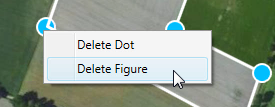
REMOVE SELECTED SHAPE
If you want to remove a shape, right-click the shape while hovering over the shape and click delete shape.
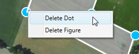
REMOVE SELECTED POINT
If you want to remove a point from either a path or an area shape, select a point, right click and select delete point.
REMOVE ALL SHAPES
You can clear all measuring shapes from the map viewer by clicking on the clear all button in the Menu dialog box.

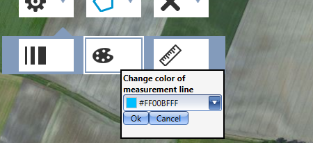
ADJUST LINE COLOR
If you to adjust the color of the line which you are drawing with, you can do it in the settings menu.
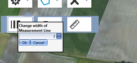
ADJUST LINE WIDTH
You can adjust the drawing line width from the settings menu.
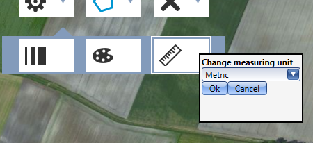
CHANGE UNIT TYPE
You can adjust the Unit Type between Imperical and Metric from the menu.